Four inches of rain cause widespread damage throughout the Warwick Valley


More than four inches of rain fell within a brief few hours during the early morning hours of Saturday, May 31, causing widespread flooding and tree damage throughout the Warwick Valley.
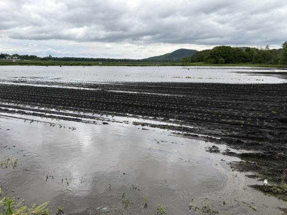
In the Black Dirt Region many of the parcels of soil, already moistened from lighter, though sustained, rains from the previous week, were unable to absorb the rapid discharge of so much precipitation in a short amount of time, resulting in flooding in many areas. Agricultural areas adjacent to County Route One, for example, resembled a shallow lake.
Farmers are hoping that the forecast in the net few days, that call for more sunshine and little or no rainfall, would allow the soils a chance to dry up a bit and not return to their historical moniker, “Drowned Lands.”
In 2021 work was completed from the Pochuck confluence to County Route 1 that had provided enhanced flood protection to agricultural fields. The currently proposed bench project would extend and enhance the protection provided by the first three phases of the earlier stages.
The proposed additional phases, according to the joint application form in 2021, would involve “creating floodplain benches on both sides of the Wallkill River by excavating down to the approximate bankfull elevation.
“Removed soil will be used in two primary ways:
“1) placement on adjacent agricultural fields to replenish topsoil and improve drainage characteristics; and
“2) export from the floodplain for various uses such as the soil aggregate market or for general fill purposes.”
The project’s Phase 1-3 was begun near the Merritts Island region of the Wallkill, where the river’s tributaries include Rutgers Creek and Black Walnut Creek.
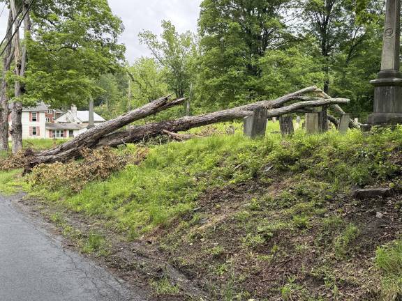
Meanwhile, when grounds are soaked so thoroughly by additional rainfall, the roots of certain trees have nothing to anchor them any more and many simply topple over, like the ancient tree that fell into the historic Amity Church’s cemetery at the corner of Newport Bridge Road and Amity Road.
Climate change and subsequent alterations in weather patterns have challenged many of the conservation activities which have been in progress throughout the Warwick Valley for decades. Unpredictable precipitation levels have made historic measurements of flood levels nearly obsolete. Tributaries of rivers like the Wawayanda, the Pochuck, and Walkill require sustained monitoring in order to balance the requirements of farmers, residents, fishing, boating and recreational activities.
Photo credits: Peter Lyons Hall
Peter Lyons Hall